December 14, 2013
The City of Beaumont, CA put on a great Christmas Light Parade. There were an array of floats ranging from Fire Trucks, ATV’s, Trailers with Santa and even a decked out Stater Bros Semi Trucks. See the Video Below

December 14, 2013
The City of Beaumont, CA put on a great Christmas Light Parade. There were an array of floats ranging from Fire Trucks, ATV’s, Trailers with Santa and even a decked out Stater Bros Semi Trucks. See the Video Below
12/2/13
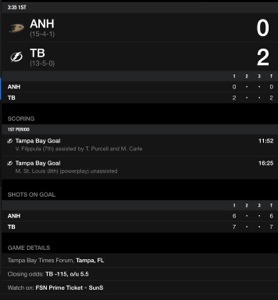
Sports Updates
Ducks trail Tamba Bay 2-0
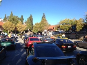
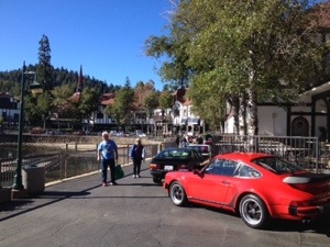
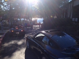
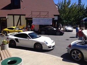
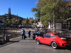
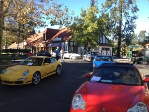
11th Annual
PCA Riverside Region
PORSCHE Timeline 2013
The Porsche Timeline Exhibition features cars which illustrate the evolution of Porsche automobiles from the early 1950s to the present. Cars are displayed in chronological order along the Lake Arrowhead waterfront and throughout Lake Arrowhead Village. The exhibit includes placards which discuss the features of the various models. Each car has a data sheet, which includes specific historical and other information of interest. Participants have a chance to relax in a pleasant location, display their cars to other exhibitors, to other members of the Porsche Club and to the public, as well as having the opportunity to discuss the significance of their cars with all who attend. And as the Village is celebrating Oktoberfest during this Exhibition, there is always great food and merchandise available from the local vendors.


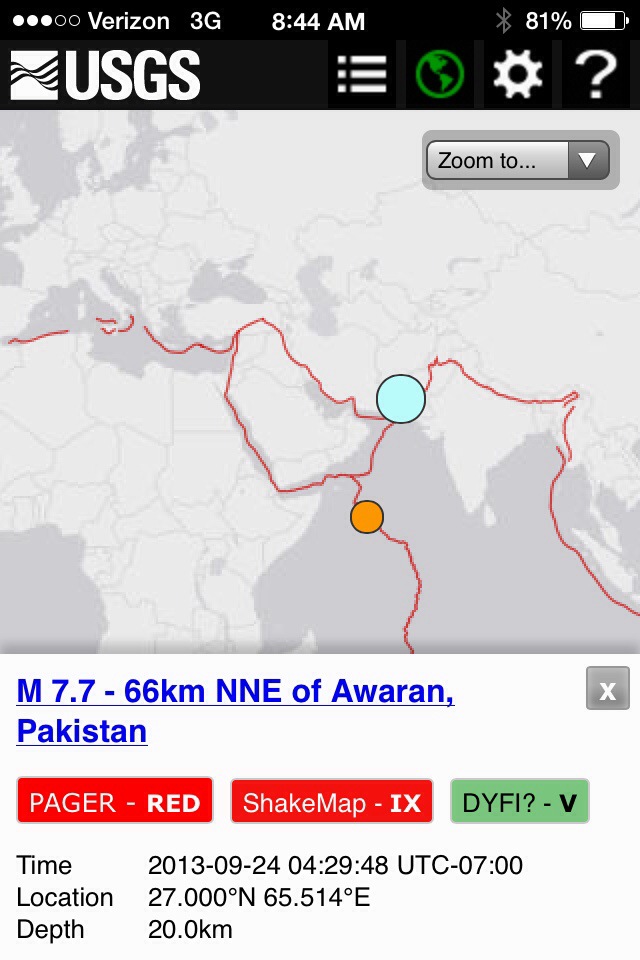
Pakistan: A huge earthquake hit southwest Pakistan on Tuesday, killing at least 327 people and more are missing, toppling scores of homes and sending people around the region rushing into the streets in panic. This large quake may have created a island off the shore, south of the coast.
The 7.7-magnitude quake centred in Baluchistan province’s Awaran district was felt as far afield as New Delhi and Dubai, residents said.
Beaumont, CA 92223 Live Storm Cam

Refresh WebCam
Click Here

FLASH FLOOD WARNING FOR…
NORTHWESTERN RIVERSIDE COUNTY IN SOUTHERN CALIFORNIA…
SOUTHWESTERN SAN BERNARDINO COUNTY IN SOUTHERN CALIFORNIA…
THIS INCLUDES THE CITIES OF…FOREST FALLS…YUCAIPA…REDLANDS…
* UNTIL 545 PM PDT
* AT 142 PM PDT…NATIONAL WEATHER SERVICE DOPPLER RADAR INDICATED
FLASH FLOODING FROM STORMS OVER THE WARNED AREA.
* LOCATIONS IN THE WARNING INCLUDE BUT ARE NOT LIMITED TO MENTONE…
FOREST FALLS…RUNNING SPRINGS AND HIGHLAND
* DRAINAGE IN THE FOREST FALLS AREAS INCLUDE MILLS CREEK…PROSPECT
CREEK…AND CLARKS CREEK…WHICH WILL LIKELY RUN HIGH AND OVERFLOW
THEIR BANKS.


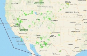
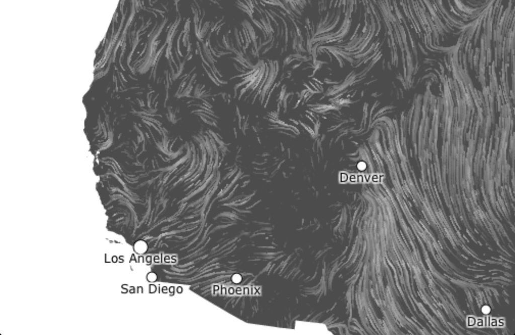
Monsoonal moisture and moisture from the remnants of Tropical Storm Ivo will continue to increase today and spread slightly farther west into portions of the inland valleys.
LIGHT TO MODERATE SHOWERS ARE EXPECTED TO CONTINUE BEYOND 5 PM.
AT 330 PM AN AREA OF SHOWERS EXTENDED FROM NEAR CAMPO…NORTH TO
THE LUCERNE VALLEY AREA. THERE WERE ALSO MODERATE SHOWERS BETWEEN
ONTARIO AND WRIGHTWOOD. THE SHOWERS WERE MOVING NORTH AT ABOUT 20
MPH. RAINFALL AMOUNTS OF UP TO 0.05 INCHES PER HOUR CAN BE
EXPECTED FROM THE HEAVIEST SHOWERS.
MONSOONAL MOISTURE AND MOISTURE FROM THE REMNANTS OF TROPICAL
STORM IVO WILL CONTINUE TO INCREASE TODAY AND SPREAD SLIGHTLY
FARTHER WEST INTO PORTIONS OF THE INLAND VALLEYS. IT IS POSSIBLE
THAT CLOUD COVER COULD MAKE FOR A LITTLE LESS THUNDERSTORM
ACTIVITY THIS AFTERNOON…BUT IF THUNDERSTORMS DO FORM…HEAVY
RAINFALL AND FLASH FLOODING ARE LIKELY…ESPECIALLY IN THE
MOUNTAINS AND DESERTS WITH ISOLATED FLASH FLOODING IN THE INLAND
VALLEYS. THERE SHOULD BE BETTER SURFACE HEATING TOMORROW…AND SO
ANOTHER ROUND OF WIDESPREAD THUNDERSTORMS AND HEAVY SHOWERS IS
LIKELY TUESDAY AFTERNOON THROUGH EARLY EVENING IN THE MOUNTAINS
AND DESERTS…SO THE FLASH FLOOD WATCH WAS EXTENDED THROUGH
TUESDAY EVENING FOR THOSE AREAS. HEAVY RAINFALL IN BURN AREAS OF
THE PAST 2 YEARS WILL LIKELY LEAD TO MUD AND DEBRIS FLOWS NEAR
AND BELOW THOSE BURN AREAS. ISOLATED THUNDERSTORMS WITH LOCALLY
HEAVY RAINFALL ARE ALSO POSSIBLE THROUGH LATE TONIGHT THROUGH
EARLY TUESDAY MORNING DUE TO AN UPPER DISTURBANCE MOVING THROUGH.
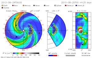
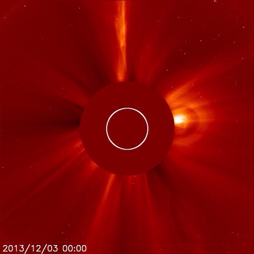
We have two CMEs Coronal Mass Ejections headed our way from the Sun. He launched one CME with the M Flare few days back, and other CME is from yesterday’s filament eruption.
It will be a direct hit to earth as seen in the image below.