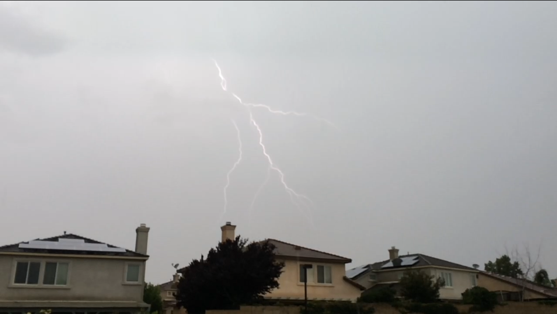
On July 18th
The summer storms begin to roll in.
Image credit CDVIDEOWEB
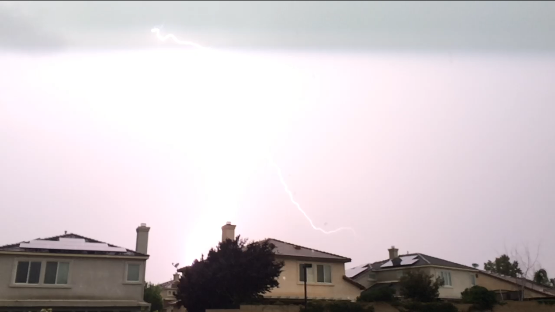

On July 18th
The summer storms begin to roll in.
Image credit CDVIDEOWEB
Lake Fire is burning in the Barton Flats area south of Big Bear near Highway 38, is now 10 perfect contained. Highway 38 is currently still CLOSED. Alternative routes are highway 330 and highway 18.
The Lake Fire broke out on Wednesday and has grown in size, as flames consumed heavy brush and trees along the Bear Bear terrain.
The fire was burning away from communities, but there are about 150 structures threatened and under evacuation.
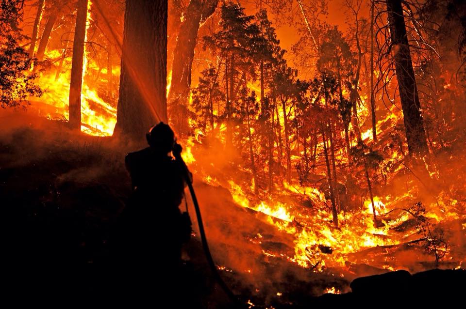
Big Bear, CA 2015 Lake Fire San Bernardino Mountains
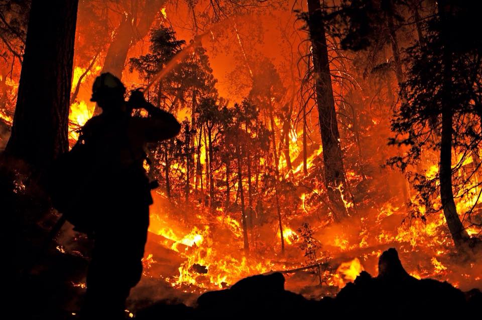
Lake Fire Big Bear 2015
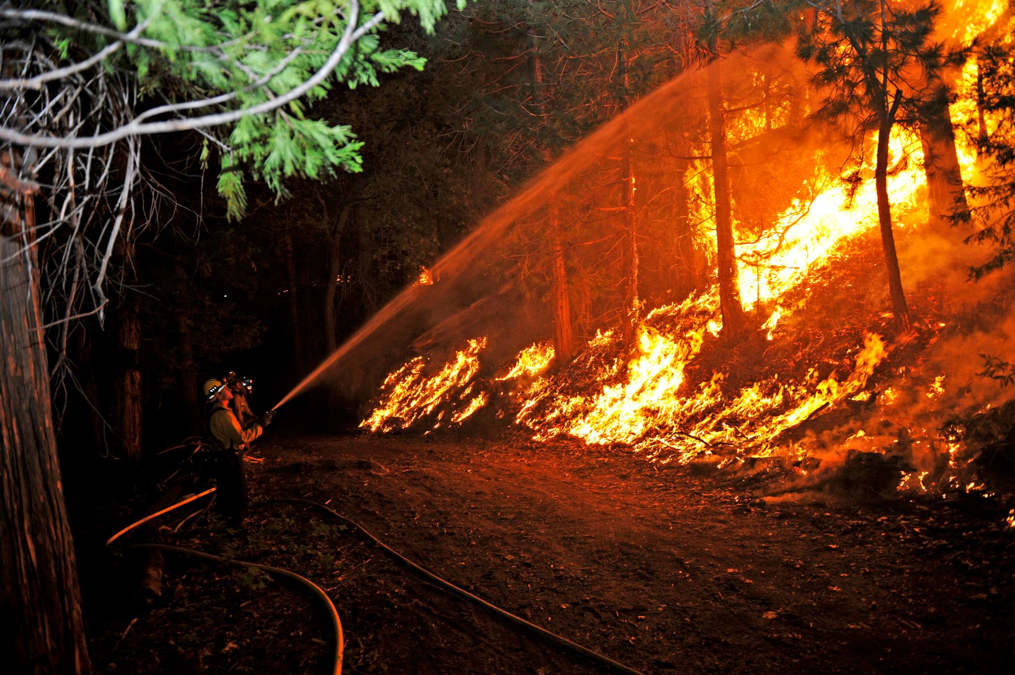
Lake Fire Big Bear 2015
The cause of the Lake Fire remains under investigation.
December 14, 2013
The City of Beaumont, CA put on a great Christmas Light Parade. There were an array of floats ranging from Fire Trucks, ATV’s, Trailers with Santa and even a decked out Stater Bros Semi Trucks. See the Video Below
Tonight A chance of drizzle after 11pm. Patchy fog after 11pm. Otherwise, increasing clouds, with a low around 52. West wind 5 to 10 mph becoming light southwest in the evening.

Refresh WebCam
Click Here
Sunday A chance of drizzle before 11am. Patchy fog before 11am. Otherwise, mostly cloudy through mid morning, then gradual clearing, with a high near 75. West wind 5 to 10 mph.
Sunday Night Clear, with a low around 54. West wind 5 to 10 mph becoming light and variable.
Monday Sunny, with a high near 87. East wind around 10 mph.
Monday Night Clear, with a low around 58. Calm wind.

Beaumont, CA 92223 Live Storm Cam
Refresh WebCam
Click Here

FLASH FLOOD WARNING FOR…
NORTHWESTERN RIVERSIDE COUNTY IN SOUTHERN CALIFORNIA…
SOUTHWESTERN SAN BERNARDINO COUNTY IN SOUTHERN CALIFORNIA…
THIS INCLUDES THE CITIES OF…FOREST FALLS…YUCAIPA…REDLANDS…
* UNTIL 545 PM PDT
* AT 142 PM PDT…NATIONAL WEATHER SERVICE DOPPLER RADAR INDICATED
FLASH FLOODING FROM STORMS OVER THE WARNED AREA.
* LOCATIONS IN THE WARNING INCLUDE BUT ARE NOT LIMITED TO MENTONE…
FOREST FALLS…RUNNING SPRINGS AND HIGHLAND
* DRAINAGE IN THE FOREST FALLS AREAS INCLUDE MILLS CREEK…PROSPECT
CREEK…AND CLARKS CREEK…WHICH WILL LIKELY RUN HIGH AND OVERFLOW
THEIR BANKS.
It looks like more rain may be on the way for Southern California, as we have a 60% Chance another Tropical Storm is forming just South of Mexico.
NOAA NHC Message
THIS SYSTEM HAS A HIGH CHANCE…60 PERCENT…OF
BECOMING A TROPICAL CYCLONE DURING THE NEXT 48 HOURS…AND A HIGH
CHANCE…80 PERCENT… OF BECOMING A TROPICAL CYCLONE DURING THE
NEXT 5 DAYS WHILE IT MOVES WEST-NORTHWESTWARD AT 15 MPH. LOCALLY
HEAVY RAINFALL IS EXPECTED TO CONTINUE OVER PORTIONS OF SOUTHERN
MEXICO DURING THE NEXT FEW DAYS IN ASSOCIATION WITH THE LOW…AND
INTERESTS IN THAT AREA SHOULD MONITOR THE PROGRESS OF THIS SYSTEM.

We have an area of Low pressure to our South and another High pressure west of Central California.

Expected the High and Low pressure convergence to possibly generate more thunder storms and flash flooding to Western States thru Sunday.

Sources:
http://www.weather.gov/satellite#ir
http://www.nws.noaa.gov/outlook_tab.php
http://radar.weather.gov/Conus/southrockies.php