

Tag Archives: weather
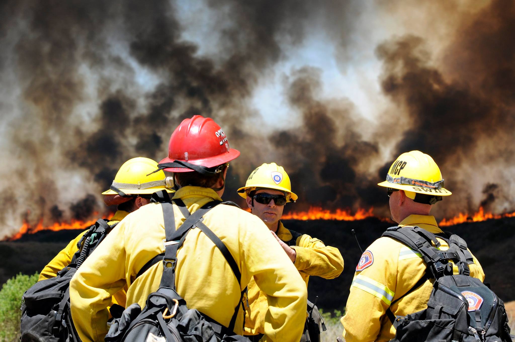
San Diego Fire Update 5-17-14
Some of this info is from last night, the info I have for the fires on base is most current
The Cocos Fire in San Marcos is at 3,018 acres and is 70 percent contained
The Bernardo Fire is at 1,548 acres and is 90 percent contained
The Tomahawk Fire on base is at 6,500 acres 60 percent contained
Las Pulgas Fire on base is at 15,000 acres 40 percent contained
The Talega Fire on base (San Mateo Fire) 800 acres 25 percent contained
San Diego County Fire Update 5/16/14
The following are the latest status on fires in San Diego County as of Friday morning with information provided by fire officials:
-The Cocos Fire in San Marcos is at 3,018 acres and is 10 percent contained.
-The Bernardo Fire in San Diego and Rancho Santa Fe is at 1,548 acres and is 90 percent contained.
-The Tomahawk Fire on Camp Pendleton is at 6,300 acres and is 23 percent contained.
-The Las Pulgas Fire on Camp Pendleton is at 8,000 acres and is 5 percent contained.
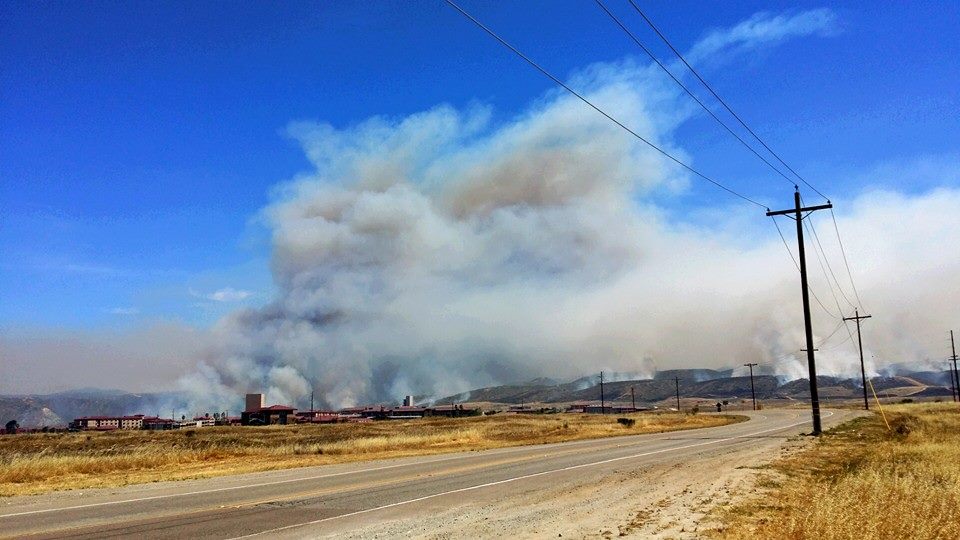
Fire officials are reporting these fires are fully contained:
-The Poinsettia Fire in Carlsbad is at 400 acres and is 85 percent contained.
-The Highway Fire in Deer Springs is at 380 acres and is 100 percent contained.
-The Freeway Fire on the Naval Weapons Station in Fallbrook is 56 acres and is 100 percent contained.
-The River Fire in Oceanside is at 105 acres and is 100 percent contained.
-The Aurora/Lakeside Fire is at 17 acres and is 100 contained.
San Diego County Fire Map 2014
Shared from here: http://fire.escondido.org/wildfire-resources.aspx
5/16/14 Space Weather and Weather FORECASTS
WX Forecast:
Areas in-and-around Philly, PA… though this flooding threat is for much of PA, MD, VA, DE and parts of NJ.
Rain, rain and some more rain… yup, beginning tonight and into tomorrow, expect a good deal of rain… mainly tomorrow. FLASH FLOODING is a good possibility and remember DO NOT DRIVE THROUGH FLOOD WATERS…. flooded roadways WILL OCCUR tomorrow, so don’t be a moron. Expect rain to begin mid morning and last through late afternoon/early evening, heavy at times.
(P.S. If you do get stuck trying to drive through flooded roads, I will make an effort to personally come out there, and backhand you across the face.)
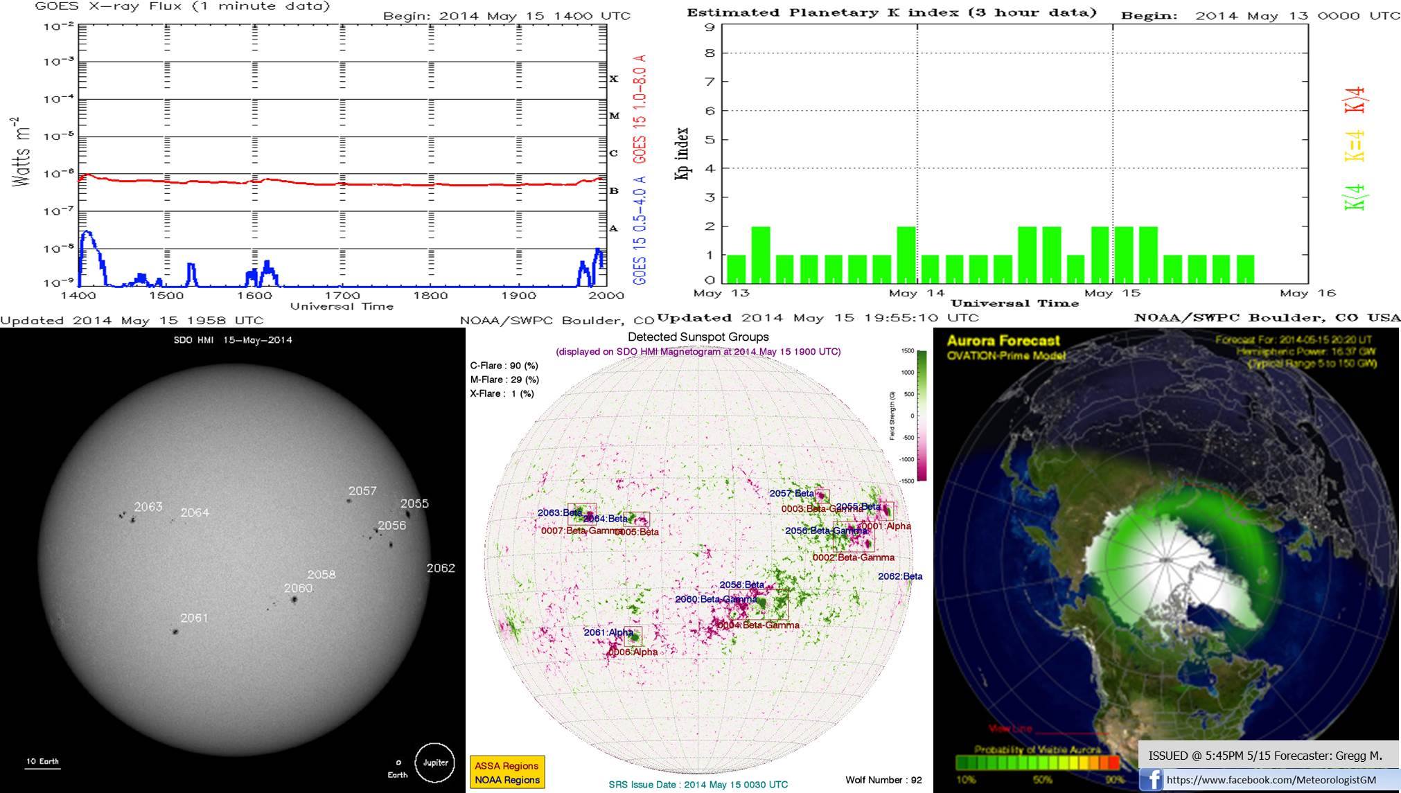
SPWX Forecast:
The sun continues to be fairly quiet. A few sunspots visible on the solar disk, but nothing to serious looking. Flare probability forecast:
C-Class: 87%
M-Class: 20%
X-Class: 2%
Solar winds are tranquil, but may see slight enhancement over the next 2 hours due to a recurrent positive-polarity coronal hole high speed stream (CH HSS), but nothing to crazy. Expecting the Kp-index to remain at or below 3. Aurora probability remains low for tonight. Areas in northern Canada and Alaska have the best shot of seeing anything.
El Niño 2014 Wet weather in the West Coast
El Niño Page
Are we going to have a El Niño this year?
More information will be posted soon
#dailysun May 12 2014
iMountainNews Daily Sun #dailysun
Big Bear Activity Report
Solar activity is moderate. C-class events were observed in region NOAA 12055, 12056 and 12058. Region NOAA 12055 shows some new flux emerging near the trailing spot. Region NOAA 12056 is now a delta configuration again. C-class events are likely in region NOAA 12056. An M-class flare is possible in this region as well. C-class events are possible in regions NOAA 12055 and 12058.
Solar Videos
Soho Video 5-8-14 to 5-12-14
Solar Flaring is picking up on the 11 – 12
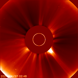
SDO Video 5-10-14 5-12-14
For more data go to http://sdo.gsfc.nasa.gov/data/
Credit NASA, SOHO
5/9/14 Forecasts Spaceweather and Weather
5/9/14 Forecasts:
WX Forecast:
Mostly cloudy for much of the night with a few isolated showers across the region after midnight. Heading into tomorrow, expect mild temperatures reaching into the upper 70s to near 80. Scattered showers will be more widespread than tonight, with a few embedded thunderstorms.
Morning low: 55; High: 79
SPWX Forecast:
As expected solar activity has continued to increase. An M5.2 solar flare occurred from region 2056. No CME was detected with this event. I continue to leave solar flare probabilities fairly elevated.
C-Class: 97%
M-Class: 58%
X-Class: 23%
Solar winds remain nominal but will increase in about 48 hrs. as we see the effects of a recurrent CH HSS. Aurora activity will likely reach into Alaska and Canada as we see a kp-index of 4 tonight.
5/7/14 FORECASTS
WX Forecast:
A beautiful night overall to go do some stargazing. Mainly clear skies and cool conditions, dropping into the 40s. Tomorrow should be nice for the most part, although there is a slight chance for an evening shower across the region (30%).
Morning low: 44; High: 72.
SPWX Forecast:
As expected, activity has recently increased, with two M-Class flares in the last 24 hrs. I don’t see the activity calming down anytime soon. While both flares originated from sunspot 2051 (which just turned around the western limb, away from Earth) region 2055 and 2056 should be watched, as they had released flares prior to turning toward Earth. Both of these regions I could see becoming a Beta-gamma-delta over in the near-future. I am still keeping the solar flare probabilities fairly elevated over the next 24-48hrs.
C-Class: 91%
M-Class: 53%
X-Class: 18%
Looking at the solar winds they continue at nominal levels, but expect an increase over the next 24-48hrs, thanks to the CH-HSS. As a result we could also see geomagnetic activity increase just a bit, potentially seeing aurora reach in central Canada and Alaska. Kp-index is expected to remain below at or below 4 over this period.
Our World is Changing Beyond 2012
Shared from Suspicious0bservers